Deutsch
 English
 中文
中文
 Danish
 Eesti
Eesti
 Español
 Suomi
Suomi
 Français
 Italiano
 日本語
日本語
 한국
한국
 Nederlands
 Norge
Norge
 Polski
 Portugues
 Русский
 Svenska
 Türkçe
 العربية
 Romanesc
 български
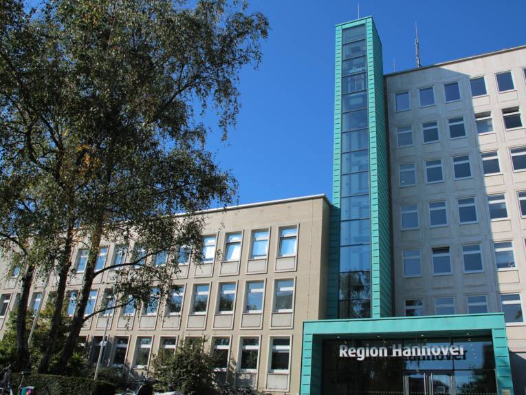
Region Hannover
The environmental department
Everything from a single source: The "Region Hannover"
Region Hannover was founded on 1 November 2001. Region Hannover is the legal successor of the Landkreis (District) and the Kommunalverband Großraum Hannover (communal organisation of the greater area of Hannover) and comprises the area of the former Landkreis and the state capital Hannover with an area of 2290 square kilometres. Almost half of the 1.115 million people living in the 21 cities and municipalities of the region live in the state capital (515,000). The population density hereby varies between 100 people per square kilometre in the outer areas of the region to more than 5000 people per square kilometre in the urban area of the city of Hannover.
The area of the Region Hannover is not determined by natural borders. It stretches approximately between the Deister chain of hills in the south, River Aller in the north as well as the Steinhuder Meer (Lake Steinhude) in the west and the Rivers Erse and Fuhse in the east. The Region has an east-west expansion of approx. 72 kilometres and a north-west expansion of 60 kilometres. The highest point is the Bröhn in the Großer Deister with 405 m above sea level. The lowest point is 26 metres at Leine level near Stöckendrebber.
One of the largest communal environmental authorities in Germany - the Environmental Department
The founding of Region Hannover provided the unique opportunity to principally combine all executive tasks of environmental protection, the lower as well as the upper environmental protection authorities, here. Today, the Environmental Department of Region Hannover is one of the largest communal environmental authorities in Germany. The near 160 employees from the offices for nature conservation, for water and waste of the former Landkreis Hannover, the office for environmental protection of the state capital Hannover and the nature conservation department of the former Hannover local government transferred to the newly established department. As even the organisational process was characterised by a variety of administration philosophies from the very start of the Region, this was also initially reflected in the practical work.However, the initial ‚side by side‘ and sometimes ‚against each other‘ of the former organisational units turned into cooperation much sooner than expected by some sceptics. Since then, it is noticeable that the integration of the employees from the different authorities was successful and the expected synergy effects could be achieved by the concentration of the tasks in one office. Tasks are generated often enough in Region Hannover, the largest agglomeration in Lower Saxony, to occupy and utilise the scientific and technical experts required for competent processing.
Among all this, the close links to other sections of district management is implicit. This particularly applies for cross section tasks such as the adaptation to climate change which can only be mastered effectively in cooperation with e.g. traffic planning, disaster control, property management or regional planning. But, also other sectors, such as local recreation, are an important contribution in making nature and environment in the Region an experience for the people living here. The incidental tasks in the region require competent processing. This is ensured by the necessary administrational and technical personnel. The expertise of the Environmental Department is appreciated and used far beyond the borders of the region.
Nature’s settings
The natural landscape allows the division of the area into two major parcels: the Weser-Aller lowlands and the Börden. Their line of separation approximately coincides with the course of the Mittellandkanal (Midland Canal) in the east-west direction. This is supplemented by the Weser-Leinebergland in the south-west. The Weser-Aller lowlands consist of the Urstromtal (ice-marginal valley) of the same name and - adjacent in the south - flat undulating moraine landscape. These are parapets originating in the Ice Age, which were pushed in front of the gigantic glaciers similar to a bulldozer. The western part features expansions of upland moors. The southern edge exhibits Mesozoic rock formations pushing to the surface in some places - particularly Keuper and Jurassic chalk. Mesozoic is the earth middle age.
This means that the rocks were created some 251 to 65 million years ago. Loess islands appear in small transition areas to the southern adjacent Lössbörde. This mixture of clay, sand and minerals, carried there by winds several thousands of years ago, is extremely fertile.
Areas of forest, pastures and agricultural areas alternate on the predominately poor sandy soil and the damp Geestniederungen. It is traditionally an area for the cultivation of potatoes, vegetables and asparagus. The Börden form the transition from the flatlands to the Niedersächsisches Bergland (Lower Saxon Hills) and are characterised by an almost closed layer of loess. Moors are almost missing altogether. The loess areas are distinguished by extremely fertile chromic luvisol and black soils which form the basis for intensive agricultural utilisation (grains, vegetables, sugar beets) and the dense population of this sub-region.
Subdivision of the areas
Agriculture is the type of usage with the greatest areal component (more than half) in all municipalities of the Region territory, with the exception of the state capital. Yet, a structural change is indicated. The number of agricultural operations has declined. The proportion of residential and traffic areas at more than 20% of the entire area are only slightly above the Lower Saxony average of 19%. More than 19% of the area is covered by forest. More than 46% of the regional surface is declared environmental preserve. This is very encouraging, as the average in Lower Saxony is only 20%. While the areas under agricultural use have declined perceptively since the 1980’s, forest areas are increasing. Their volume is above the increase of traffic areas. In all, residential and traffic areas have increased by more than 80 square kilometres during the last 20 years. As residential areas also include sporting venues, parks and private greens, the land sealing has not increased at the specified extent.
Protecting the environment means to shape and design
Incidentally, since when does „environmental protection“ exist? Indeed, even the Bible contains references to the protection of the environment - in this case for a regulated „waste water“ disposal. The regulations of water protection and laws also reach way back into the past centuries.
A glance into the history of the official environmental protection in Germany brings us to the year 1961, when Willy Brand implored the „blue sky over the river Ruhr“. It subsequently took ten years for the former Federal Government to present a first environmental program and declare environmental protection to be an essential duty of the government.
„Environmental protection are the collective measures and endeavours intended to preserve the natural resources of plant, animal and human being and/or to re-establish a disturbed ecological balance of nature; in the proper meaning of the word, the protection from negative impacts originating from mankind‘s economic activity, his technical facilities and other civilisational circumstances, whereby the care for the environment is more effective and more economical than subsequent measures of the technical environmental protection.“ (Quoted and translated from Meyers Lexikon, LexiROM Version 3.0, 1997).
TASKS OF THE ENVIRONMENTAL DEPARTMENT | |
|---|---|
Competencies pertaining | and formative environmental |
Nature conservation | Environmental planning |
Water conservation | Climate change and climate adaptation |
Soil protection | Environment observations (monitoring) |
Waste authority | Environmental information |
Emission Protection | Environmental education |
However, the protection of the environment can and should not solely be limited to the official monitoring and implementation of environmentally friendly standards. Environmental protection is a formative task which needs to be fulfilled with the aid and within the context of the applicable environmental laws. This becomes imminently visible in the protection of nature and environment. Those wishing to maintain the natural resources in a densely populated agglomeration will have to deal with a variety of interests in the utilisation of the area. Practice shows that the interests of some region-associated cities and communities as urban development managers are not always congruent with the regional interests as environmental protection authority. There are numerous requests from cities and communities for the cancellation or partial cancellation of environmental preserves in order to build on these areas.
There are also requests from the agricultural sector to use the cultivated protected areas as free from the limitation of environmental law as possible and in accordance with the economic quirements of the farmers.
The environmental department of Region Hannover
The environmental department of Region Hannover
Everything from a single source - brochure from September 2016
Format: pdf Size: 391.78 kB