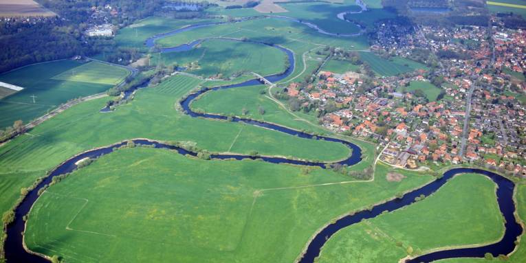
It is characterised by a varied countryside ranging from the wooded ridge of the Deister mountains in the south-west, the Steinhuder Meer lake in the north-west, and the water meadows of the Burgdorfer Aue to the east. Around half of the area has a protected status to preserve its landscape and natural habitat. Being located at the busy intersection of the A2 and A7 motorways, at the hub of major north-south and east-west long distance railway lines, and by the Midland Canal, the Hannover Region is an important site for logistics and distribution companies. Beyond this its exhibition centre and the Hannover Airport are of major international importance.
With more than 529,000 inhabitants, Hannover is by far the largest of the 21 cities and communes forming the Hannover Region, followed by Garbsen and Langenhagen, both situated in the north of the region. Neustadt am Rübenberge spreads over 357 square kilometres and is one of the most extensive cities in Germany. The smallest commune with around 14,400 inhabitants is Wennigsen.
 Deutsch
 English
 中文
中文
 Danish
 Eesti
Eesti
 Español
 Suomi
Suomi
 Français
 Italiano
 日本語
日本語
 한국
한국
 Nederlands
 Norge
Norge
 Polski
 Portugues
 Русский
 Svenska
 Türkçe
 العربية
 Romanesc
 български
 © Jochen Knobloch
 © C. Pförtner, Region Hannover